
Route 66 by motorhome: a practical guide from Chicago to California

    Leave a number with WhatsApp / Telegram
    Route 66 crosses eight states and roughly 2,400 historic miles — about 3,900 kilometres — between Chicago and Southern California. The road links city streets, prairie towns, old filling stations, neon motels, high desert and the Mojave. In 2026, it is also marking 100 years since its federal designation.

    A motorhome suits this route because the stops and the changing landscape matter as much as the destination. It gives you a kitchen, space for luggage and a consistent place to sleep while the road changes around you. It also adds a second layer of planning: fuel, legal overnight stops, water, waste tanks, electricity, vehicle length and rental-depot hours.

    This guide is written for travellers arriving from outside the United States. It explains the American terms you will see when booking an RV, uses both miles and kilometres, and covers the details that are easy to miss when planning from abroad.

    Route facts

    • Historic length: commonly cited as 2,448 miles / 3,940 kilometres.
    • States: Illinois, Missouri, Kansas, Oklahoma, Texas, New Mexico, Arizona and California.
    Rental & planning

    • Rental pattern: usually a one-way trip, subject to supplier availability and a relocation fee.
    • Planning level: moderate; historic alignments and campsites need more preparation than a standard motorway trip.

    Time & season

    • Comfortable time for the full route: 14–21 days.
    • Faster trip: 10–12 days, with longer drives and fewer stops.
    • Useful all-route windows: late April to May and September to October.
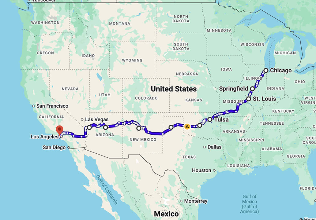
    Route 66 map from Chicago to Southern California

    Direction

    • Traditional direction: Chicago to Southern California, east to west.

    Everything in one place

    RV rental

    Motorhome selection and booking

    On-the-road support

    We’re with you every step of the way

    Route planning

    Trip preparation

    02
    04
    03
    01
    Consultations and guides
    Ready-made and custom itineraries, campground bookings

    Why Route 66 still matters

    Route 66 received its federal designation in 1926 and connected Chicago with Los Angeles through the Midwest and Southwest. It was fully paved by 1938. During the Depression and Dust Bowl years, it carried families travelling west in search of work. John Steinbeck called it the "Mother Road" in The Grapes of Wrath, and the name stayed.

    After the Second World War, family holidays and growing car ownership changed the road again. Diners, motor courts, service stations and oversized roadside signs competed for drivers' attention. Bobby Troup’s song "(Get Your Kicks on) Route 66", the television series and later films made this road culture familiar far beyond the United States.

    Interstates gradually bypassed the old highway. Route 66 was removed from the U.S. Highway System in 1985, but towns and local associations kept many sections, signs and businesses alive. That is the route people travel today: a corridor made from surviving roads and the places built around them.
    Route 66 turns 100 in 2026
    Centennial programmes, exhibitions and local events are taking place across all eight states during 2026. The calendar changes during the year, so use the official Route 66 Centennial website when choosing dates rather than relying on an old event list.

    Large events can affect accommodation and one-way RV availability in individual towns. If your dates are fixed, secure the motorhome first, reserve the hardest campground nights next, and fit smaller roadside stops around those anchors.

    Can you still drive Route 66?

    Yes, you can follow the historic corridor from Chicago to California. You will not stay on one continuously numbered federal highway. Some states sign Historic Route 66 well; elsewhere, a dedicated map is needed to distinguish an older alignment from a frontage road or the Interstate.

    The main parallel Interstates are:
    • I-55 through parts of Illinois.
    • I-44 across Missouri and Oklahoma.
    • I-40 through Texas, New Mexico, Arizona and the eastern California desert.
    • I-15 and local roads towards the Los Angeles area.

    Use the Interstate for closures, short connections and sections that do not suit the vehicle. Return to the historic road for towns, roadside businesses and intact scenic sections.
    Use a Route 66 map for the corridor and GPS for the next stop
    Standard navigation normally chooses the fastest route. On Route 66, that can move you onto I-40 or I-44 and past the places you intended to visit.

    A better system has two layers:
    1. Choose the historic alignment with a Route 66 map or specialist guide.
    2. Use Google Maps, Apple Maps or an RV-safe navigator for the next confirmed attraction, fuel stop or campground.
    Useful planning resources include the official Centennial map, the EZ66 Guide for Travelers, National Park Service Route 66 material and state Route 66 association maps. Save essential maps offline. Mobile coverage becomes unreliable on desert sections, and a printed overview makes detours easier to understand.

    Before the California desert, check the San Bernardino County National Trails Highway closure page. Flood damage, bridge work and weight restrictions can affect the historic alignment. Caltrans information for State Route 66 does not cover every county-managed section.

    How long should you allow?

    Fourteen days is a workable minimum for the complete route. You will drive on most days, but there is enough time for museums, town centres, diners and short roadside stops. Eighteen to 21 days gives the trip a more relaxed shape, including two-night stays or a Grand Canyon detour.

    Ten to 12 days can work if driving is one of the main activities and you choose your stops in advance. Seven days is better for one regional section than for the full Chicago-to-California route.

    For many days, 150−220 miles / 240−355 kilometres is a sensible target. Old-town streets, fuel stops, short attractions and campground check-in make an RV day longer than the map suggests. Western legs can stretch further because towns and services are more widely spaced.
    Protect the first and last day
    Plan at least one hotel night in Chicago before collecting the motorhome. It gives you time to recover from the flight, deal with delays and listen properly during the vehicle handover. If you normally drive on the left, it also keeps your first hours in a left-hand-drive RV short and unhurried.

    Rental depots are commonly outside the city centre and operate set collection and return hours. Treat the Chicago stay, the transfer to the depot and the first campground as three separate pieces of the plan. At the California end, leave enough time to empty the waste tanks, refuel, return the vehicle and reach your final hotel or airport without using the return morning as a sightseeing day.

    When to travel

    Late April through May and September through October usually offer the most balanced conditions across the full corridor. No single month produces the same weather in Chicago, the New Mexico high country and the Mojave.
    Spring
    The desert is usually easier to drive before peak summer heat, while the Midwest can be mild and green. Severe weather is still possible across the Plains, and nights at elevation in New Mexico and Arizona may be cold.
    Summer
    Long daylight helps with frequent stops, but heat in Texas, New Mexico, Arizona and the Mojave changes the practical plan. Start desert legs early, confirm fuel stops and carry more drinking water than you expect to use. Depending on the RV, the living-area air conditioner may require an electrical hookup or generator rather than the house battery alone.
    Autumn
    September and October often bring easier daytime temperatures and fewer peak-holiday crowds. Nights can cool quickly around Flagstaff, Williams and the Grand Canyon.
    Winter
    A regional Southwest trip can work, but the full route may include snow, ice, frozen campground water systems and seasonal closures in the Midwest and at elevation. Check conditions state by state, not from one national forecast.

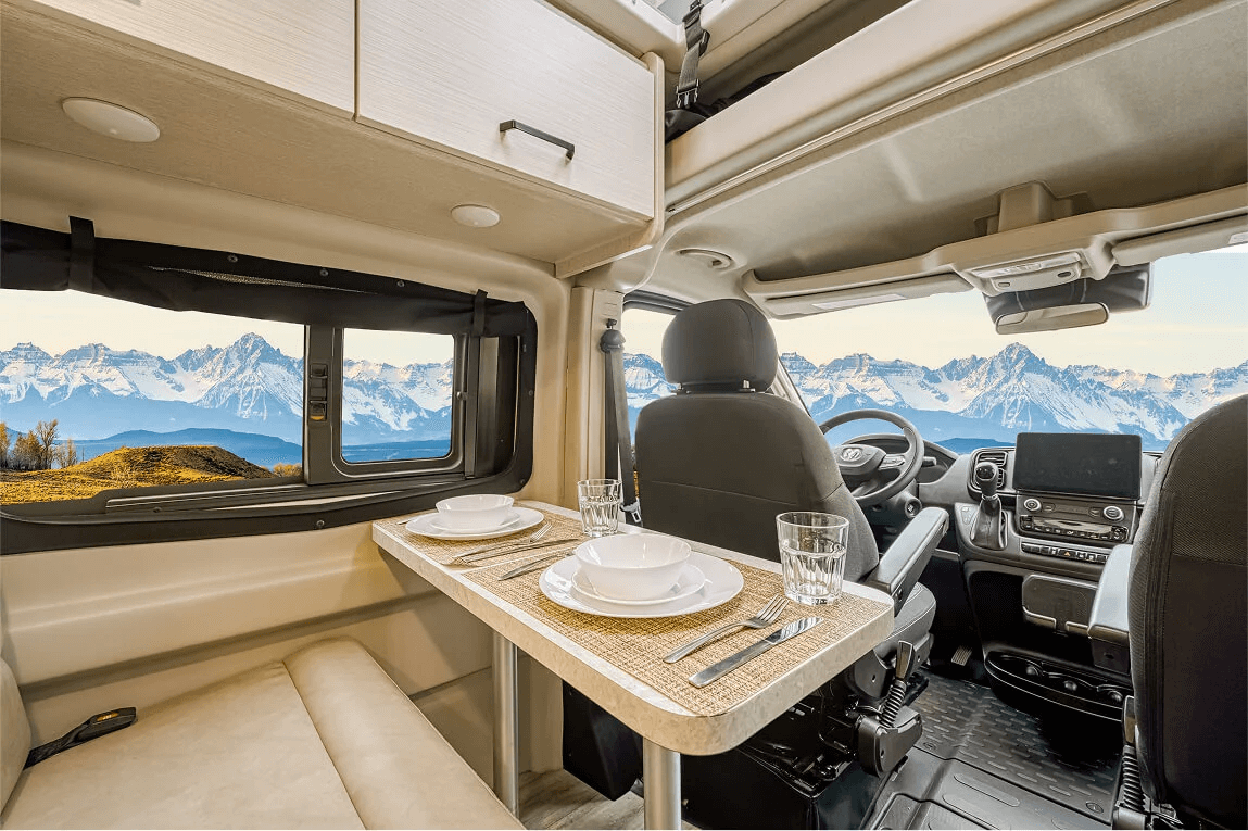
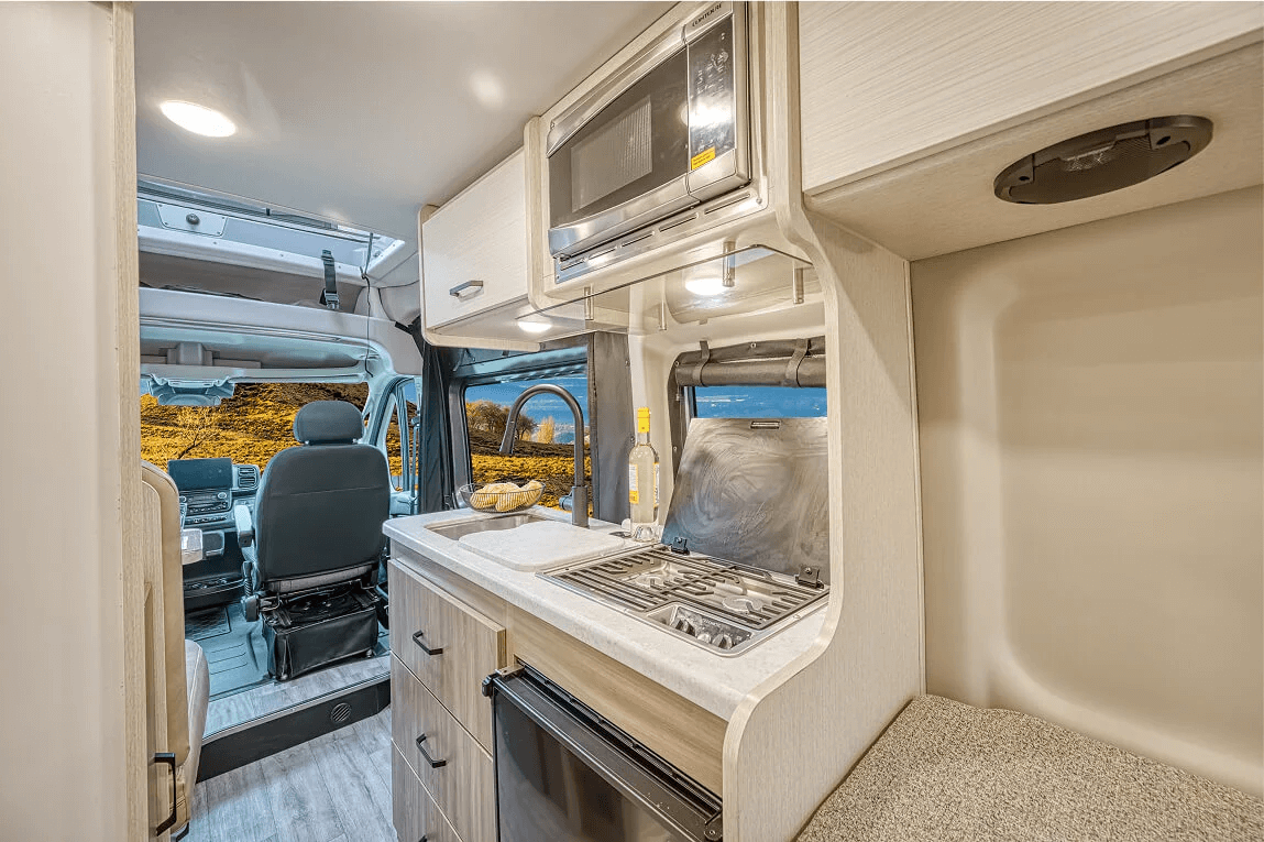
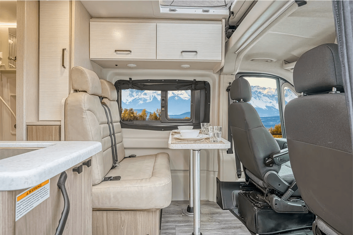
    Which RV or motorhome works best?

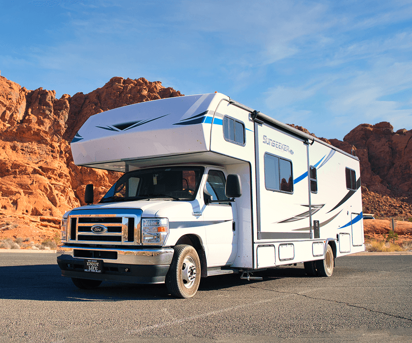
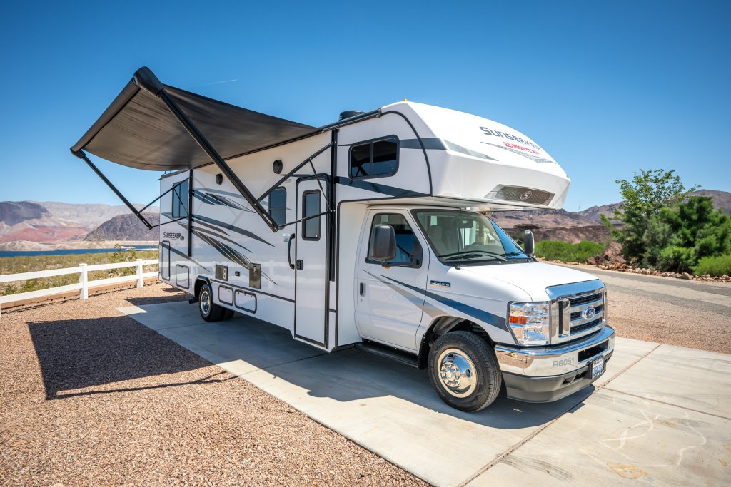
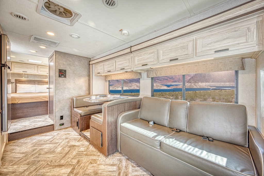
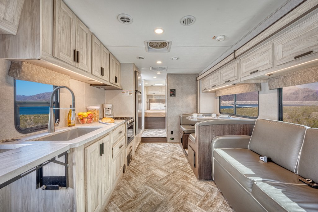
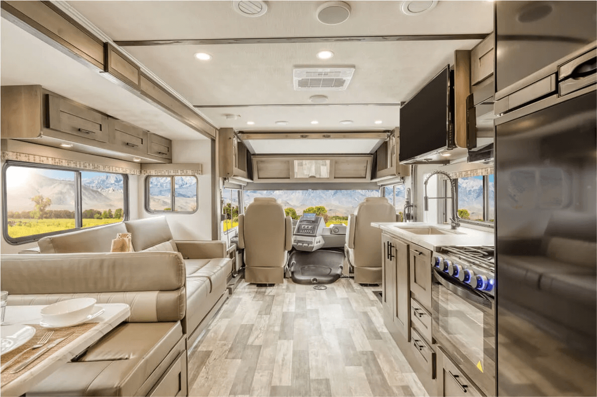
    In the United States, RV is the broad everyday term. Rental fleets usually group self-propelled motorhomes into Class B, Class C and Class A. The names describe the vehicle style, not a driving-licence category.

    Compact or standard Class C

    A useful balance for couples who want more room or families who need fixed beds, a kitchen and storage.
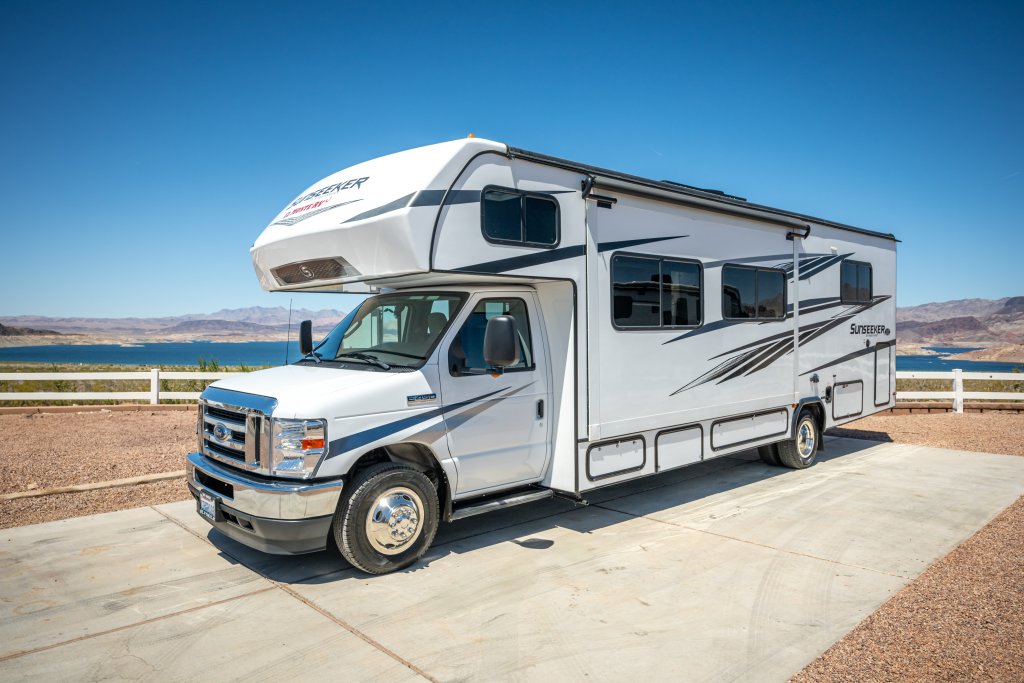
    Large Class C

    More sleeping capacity, but a longer rear overhang and more care around fuel pumps, car parks and older streets.
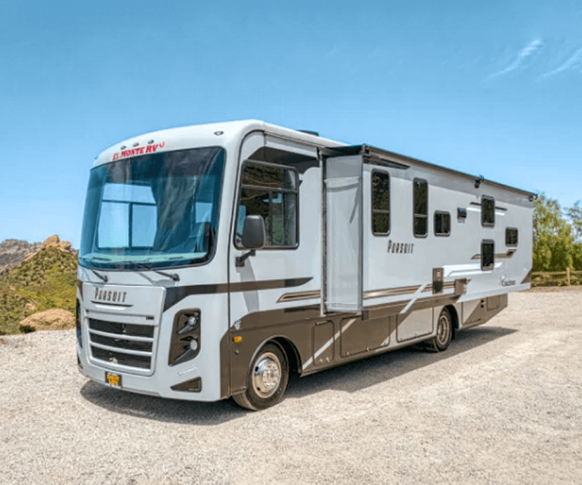
    Class A

    The most interior space, with less flexibility at roadside attractions, old urban alignments and small campground pitches.
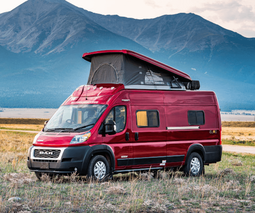
    Campervan or Class B

    Easier for two people, town stops and smaller campsites, but with less storage and a more compact bathroom or no bathroom in some models.

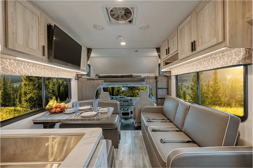
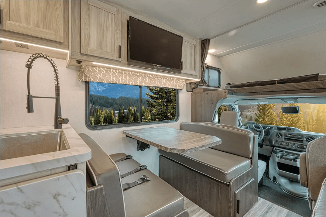
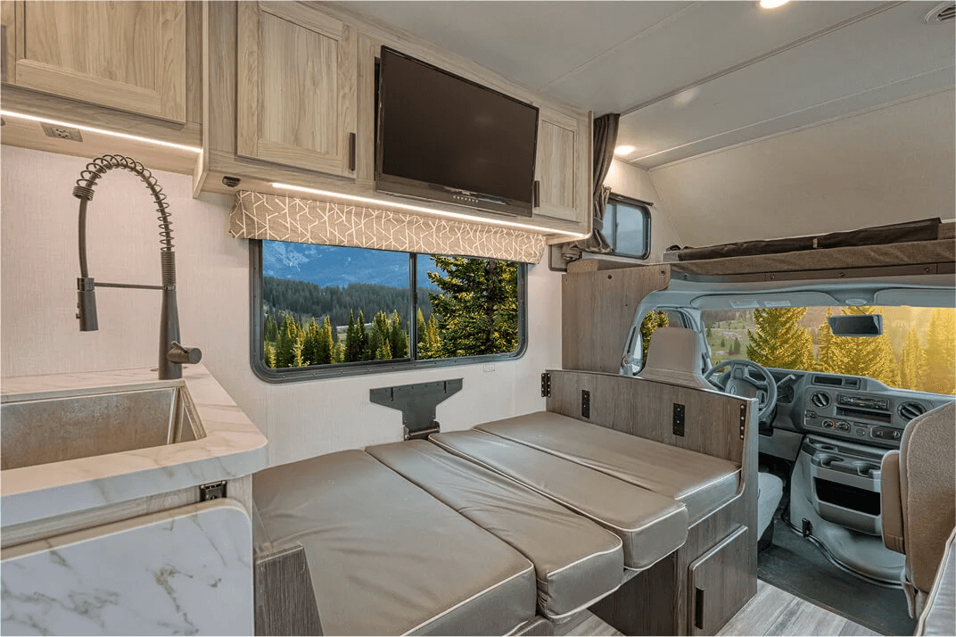
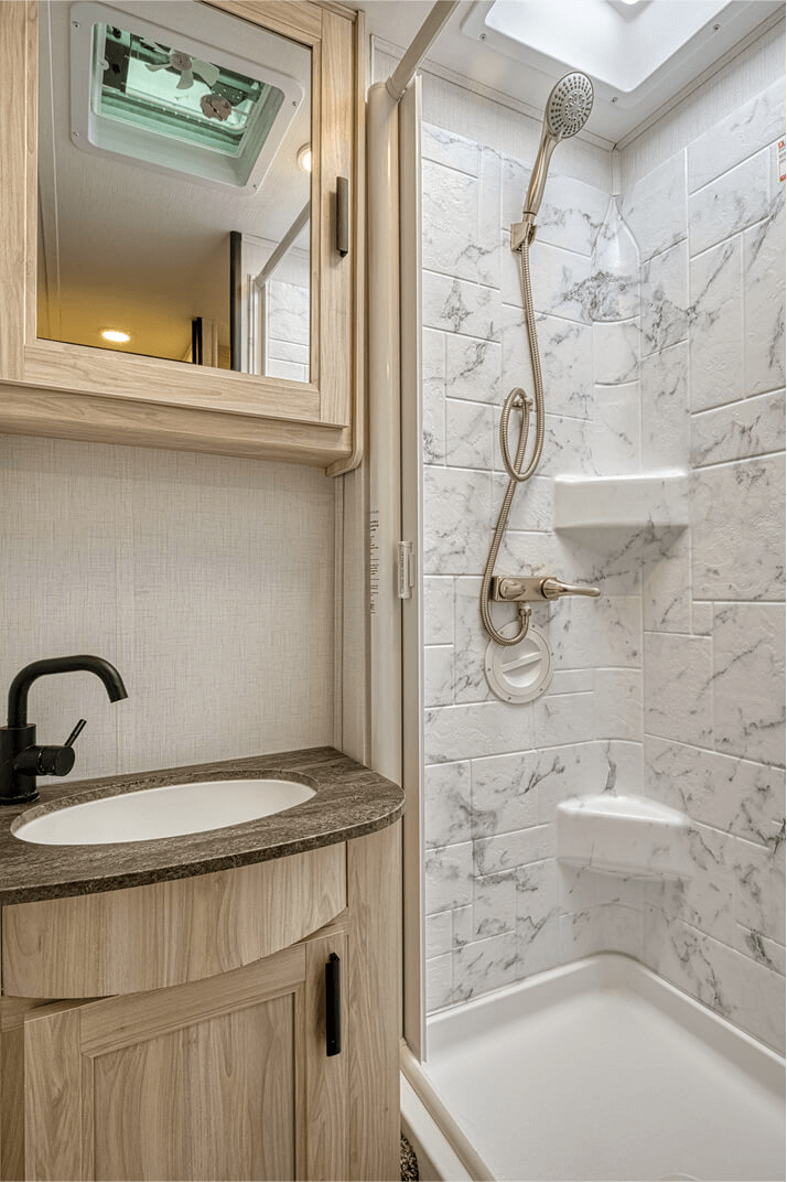
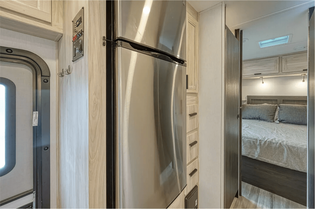
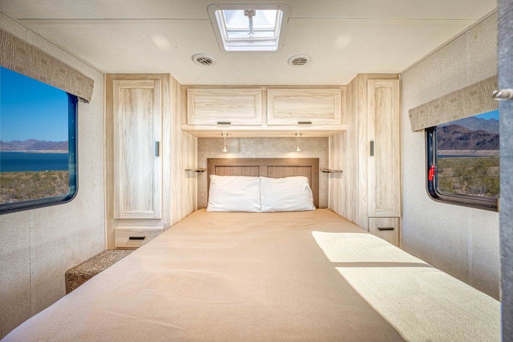
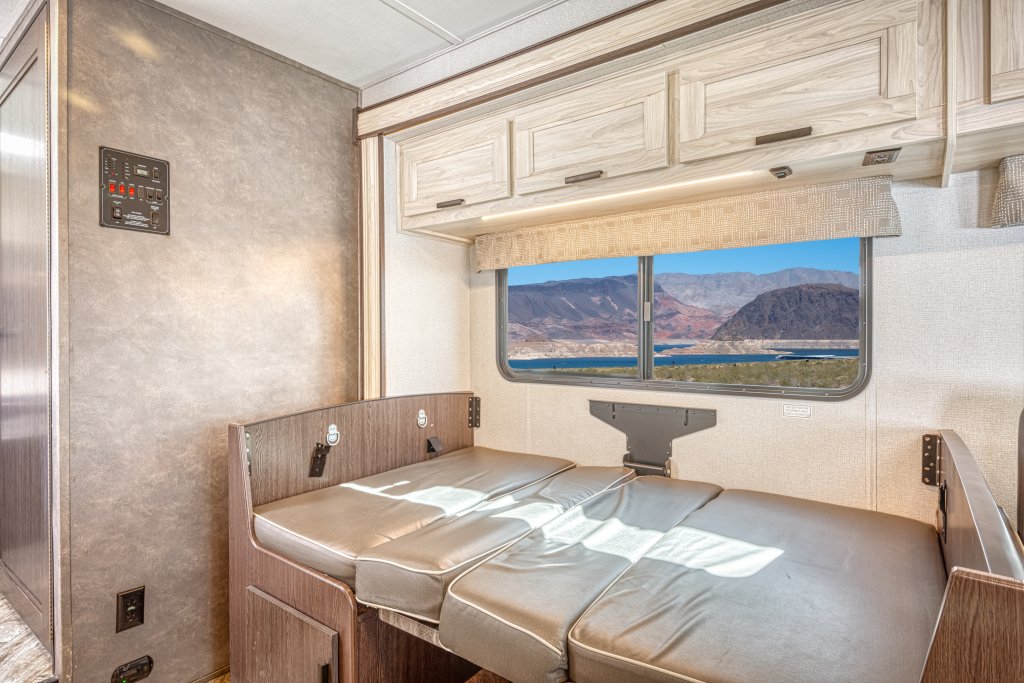
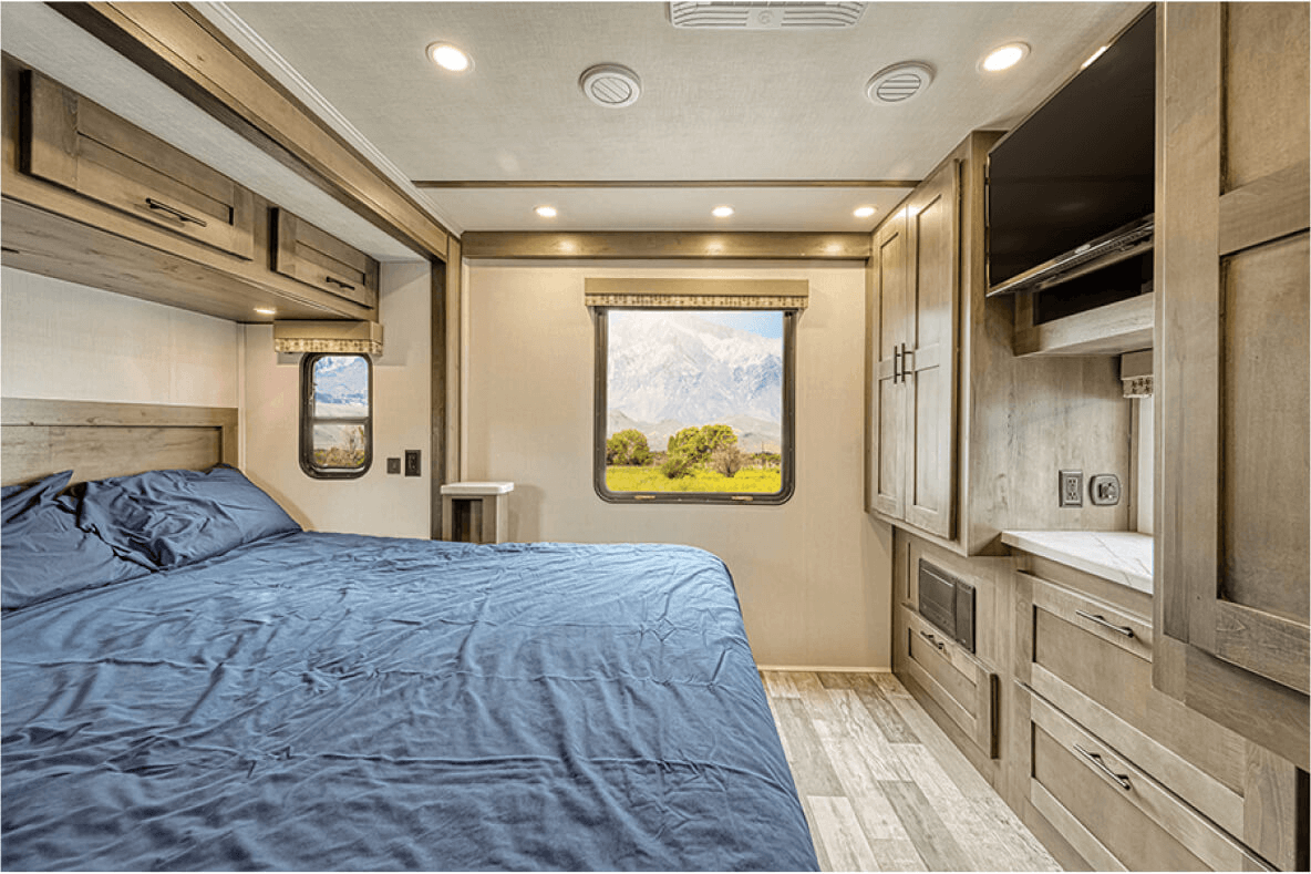
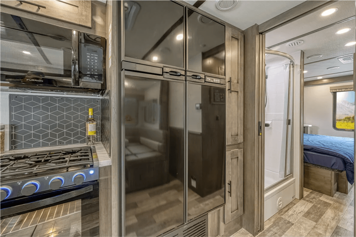
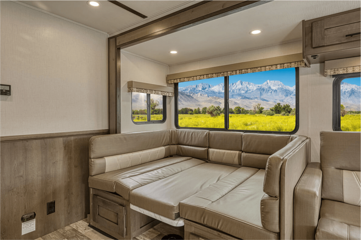
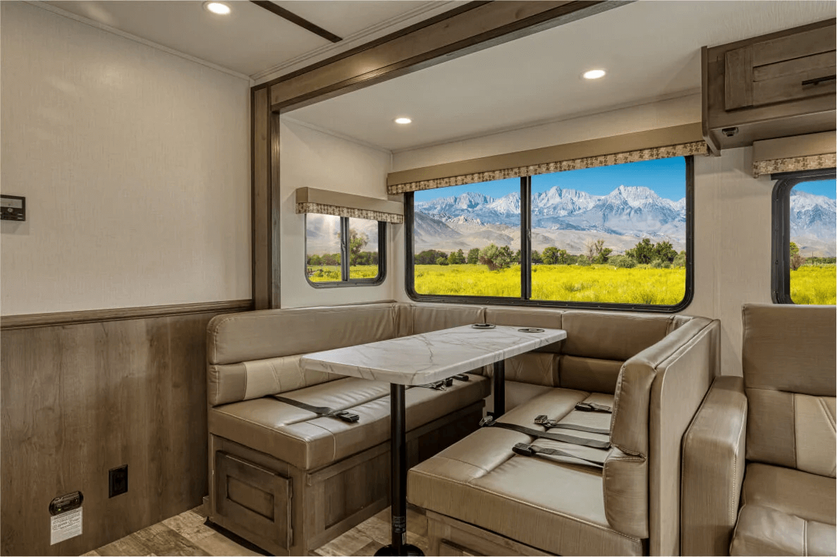
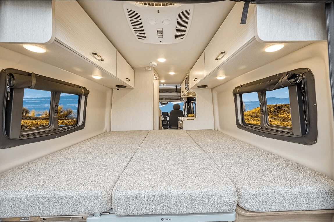
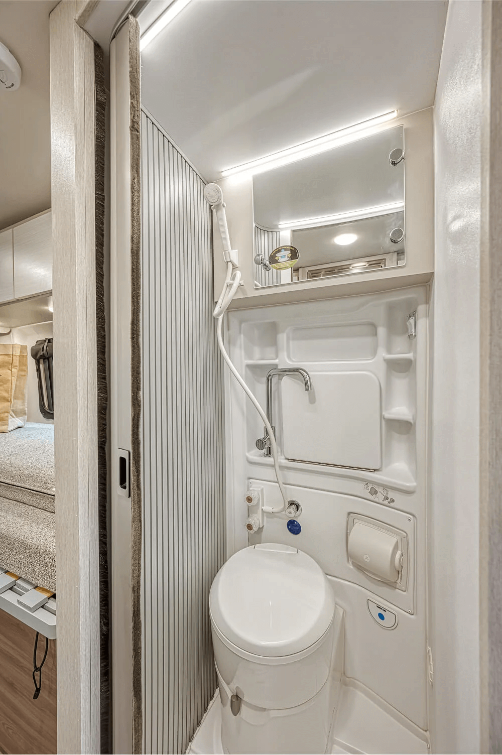
    Check the actual floor plan rather than choosing by the advertised sleeping capacity. A vehicle that "sleeps six" may require converting the dining area every night, and the beds may not suit six adults. Confirm seat belts for every passenger, bed dimensions, luggage space, shower and toilet, generator, kitchen equipment and the vehicle’s exact length and height.

    For a first Route 66 trip, the smallest model that fits the group comfortably is often easier to live with than the largest model within budget.

    What international renters need to check

    Driver age, licence format, driving-experience rules, deposits and accepted payment cards vary by supplier and vehicle class. Some rental companies ask for an International Driving Permit alongside the original licence; it is not a substitute for the licence itself. Confirm the requirement for your nationality, licence language and chosen supplier before paying.

    Before booking, check:

    • Exact pickup and return depots
    • Whether a one-way rental is available and its fee
    • Included mileage and the price of extra miles
    • Insurance options, deductible and security-deposit hold
    • Accepted cards and whose name must be on the card
    • Generator terms, if the RV has one
    • Bedding, kitchen and personal kits
    • Additional-driver conditions
    • Roadside-assistance scope
    • Vehicle dimensions and sleeping layout
    • Return time, fuel level, propane, waste tanks and cleaning rules
    One small U.S.-specific detail can save time at fuel stops: pumps sometimes ask for a ZIP code and may reject a foreign card. Paying inside the station is the usual fallback. Fuel is sold by the U.S. gallon; one gallon is about 3.8 litres.

    Great RV Trip can compare partner rental options for your dates, explain the supplier conditions and match the vehicle to the route. Availability, inclusions and the final price depend on the season, rental company, RV class and trip details.

    Choose Your RV

    Route 66 highlights by state

    Illinois: Chicago, Pontiac and Springfield
    See the Route 66 markers and central Chicago before collecting the RV outside the busiest streets. South of the city, restored filling stations and small-town main streets establish the rhythm of the route. Pontiac’s Route 66 museum and Springfield make practical early stops.

    RV planning note: use a hotel for central Chicago and make the first motorhome night outside the centre. Dense city parking adds work without improving this part of the trip.
    Missouri: St Louis and the Ozarks
    The Chain of Rocks Bridge is part of the Route 66 story, but it is now for pedestrians and cyclists; cross the Mississippi by a modern road and visit the bridge separately. West of St Louis, Meramec Caverns, old motels and the rolling Ozarks suit a slower day. Springfield, Missouri, is a convenient place to restock.

    RV planning note: state parks and private RV parks are both available, but site length and hookup type vary. Check the chosen pitch rather than relying on the campground’s general description.
    Kansas: 13 miles worth stopping for
    The Kansas section runs for only about 13 miles / 21 kilometres through Galena, Riverton and Baxter Springs. It is easy to cross quickly, yet the restored service stations and mining-town history make it one of the clearest compact sections of the old road.

    RV planning note: use Kansas as a daytime section and place the overnight around Joplin or north-eastern Oklahoma, where the campground choice is wider.
    Oklahoma: the long middle section
    Oklahoma has more than 400 miles / 640 kilometres of Route 66 and extensive drivable historic pavement. Miami, Claremore, Catoosa, Tulsa, Arcadia, Oklahoma City, El Reno and Clinton create a steady sequence of stops. The Blue Whale in Catoosa is a quick roadside visit; Tulsa adds Art Deco architecture; the Oklahoma Route 66 Museum in Clinton gives useful context before the drier western half.

    RV planning note: schedule a full-service campground, laundry and a proper food restock before continuing into the Texas Panhandle.
    Texas: Shamrock, Amarillo and the midpoint
    The Texas Panhandle brings long horizons and widely spaced towns. The U-Drop Inn in Shamrock is a well-preserved Art Deco stop. Cadillac Ranch sits outside Amarillo, and the Midpoint Cafe in Adrian marks the traditional halfway point between Chicago and Los Angeles.

    RV planning note: Palo Duro Canyon is a worthwhile overnight detour south of Amarillo. Electric-and-water sites are available, but choose a pitch that fits the vehicle and check conditions before driving into the canyon.
    New Mexico: Tucumcari, Santa Fe and Albuquerque
    Tucumcari still has a strong concentration of neon signs and old motels. Further west, the route divides: the pre-1937 alignment runs north through Santa Fe, while the later road crosses Albuquerque along Central Avenue. Decide before the trip. Santa Fe adds distance and elevation; Albuquerque is the more direct westbound line.

    RV planning note: camp outside the historic centres and explore without the motorhome. The trade-off is straightforward: a larger RV improves the evening, while a smaller vehicle is much easier on narrow streets and in limited parking.
    Arizona: Petrified Forest, Winslow, Flagstaff and the open road
    Petrified Forest National Park has a paved park road suitable for RVs, although parking at smaller overlooks can be limited. There is no RV, car or front-country camping inside the park, so sleep in Holbrook, Winslow or another nearby community.

    West of Flagstaff and Williams, the preserved road through Seligman, Peach Springs and Hackberry leads towards Kingman. The Sitgreaves Pass road to Oatman is steep and winding. Check the rental company’s rules, weather, vehicle size and your confidence before taking a large motorhome over it; I-40 is the simpler alternative.

    RV planning note: the Grand Canyon South Rim is a detour from Route 66. Trailer Village is the only in-park RV campground with full hookups; National Park Service campgrounds in the park do not provide RV hookups.
    California: Needles, the Mojave and the Pacific
    From Needles, the historic road crosses the Mojave on National Trails Highway. Roy’s Motel and Cafe in Amboy is one of the recognisable stops, but the useful planning facts are fuel, water, shade, mobile coverage and current road access.

    After Barstow, Route 66 continues through the Inland Empire and Los Angeles-area streets. The western terminus changed during the road’s history. Santa Monica Pier is the popular ceremonial finish; historical endpoints existed elsewhere in Los Angeles and Santa Monica.

    RV planning note: take the finish photo, then move to a legal overnight stop or towards the return depot. Santa Monica is not a practical place to improvise an RV night.

    Route 66 campgrounds: how to plan overnight stops

    A map label saying "camping" can describe a full-service RV park, a state-park pitch with electricity, a dry campsite or a tent-only area. Check the exact site type, not just the property name.
    Three terms you will see in U.S. campground bookings
    • Full hookups: electricity, fresh water and sewer connected at the pitch.
    • Partial hookups: usually electricity and water, with a shared dump station elsewhere in the campground.
    • Dry camping: a legal pitch without utility connections. Your limit depends on water, waste tanks, battery capacity, temperature and group size.

    For many groups, a serviced campground every two or three nights is a useful starting rhythm. A family using the onboard shower daily will need water and tank service sooner than two people using campground facilities.
    Practical campground anchors
    • Missouri Ozarks — Meramec State Park near Sullivan: a developed campground close to the corridor. Confirm site length and the exact hookup type.
    • Western Oklahoma — Foss State Park: reservable RV sites with 30- or 50-amp electricity and water; a limited number have full hookups.
    • Amarillo area — Palo Duro Canyon State Park: electric-and-water sites in a major landscape detour south of Route 66.
    • Santa Rosa, New Mexico — Santa Rosa Lake State Park: a mix of water-and-electric and electric sites, plus water points and a dump station.
    • Winslow, Arizona — Homolovi State Park: most sites have electricity and water; the park also has a dump station.
    • Grand Canyon South Rim — Trailer Village RV Park: the only RV campground inside the national park with full hookups.
    • Barstow area — Calico Ghost Town Regional Park: full-hookup, partial-hookup and dry RV sites near the western desert leg; verify current facilities before booking.

    These are route-planning anchors, not a fixed booking list. Opening dates, prices, amenities, reservation windows and road access can change.
    Campground checks that prevent expensive mistakes
    • Match the site’s maximum RV length to the actual vehicle, including a tow car if you have one.
    • Check the electrical service: 30 amp and 50 amp are different connections.
    • Confirm the arrival window and gate-closing time.
    • Check whether sewer is at the pitch or only at a shared dump station.
    • Reserve the first night, city-adjacent stays and national-park detours first.
    • Download confirmations for areas with weak mobile coverage.
    • Use designated campsites and legal overnight locations. An attraction car park or scenic pull-off does not automatically allow overnight stays.
    • Check the rental agreement before using unpaved roads; insurance and roadside assistance can be limited away from maintained public roads.

    A realistic 14-day Route 66 motorhome itinerary

    This plan covers the full corridor and leaves the Grand Canyon as an optional extension. Add two to five days for a slower trip.

    Day 1

    Chicago. Arrive, rest and explore without the RV.

    Day 2

    Chicago to Springfield, Illinois, about 200 miles / 320 kilometres. Collect the motorhome, learn the systems and use a straightforward first campground.

    Day 3

    Springfield to St Louis, about 100 miles / 160 kilometres. Add Pontiac or roadside stops earlier in the day.

    Day 4

    St Louis to Springfield, Missouri, about 215 miles / 345 kilometres. Visit Chain of Rocks separately, then continue through the Ozarks.

    Day 5

    Springfield to Tulsa, about 180 miles / 290 kilometres. Drive the Kansas section and north-eastern Oklahoma.

    Day 6

    Tulsa to Oklahoma City, about 110 miles / 175 kilometres. Tulsa, Catoosa and Arcadia fit into a shorter driving day.

    Day 7

    Oklahoma City to Amarillo, about 260 miles / 420 kilometres. Stop in Clinton and cross the western Oklahoma plains.

    Day 8

    Amarillo to Tucumcari or Santa Rosa, about 115–175 miles / 185–280 kilometres. Include Cadillac Ranch and the midpoint at Adrian.

    Day 9

    Santa Rosa to Albuquerque, about 120 miles / 195 kilometres by the direct alignment. Add distance if you choose Santa Fe.

    Day 10

    Albuquerque to Holbrook, about 230 miles / 370 kilometres. Gallup and the New Mexico–Arizona transition fill the day.

    Day 11

    Petrified Forest and Holbrook to Flagstaff or Williams, about 120–145 miles / 195–235 kilometres. Allow several hours for the park road and Winslow.

    Day 12

    Williams or Seligman to Kingman, about 90–135 miles / 145–215 kilometres. A Grand Canyon visit changes this day and usually needs an extension.

    Day 13

    Kingman to Barstow, about 210–250 miles / 340–400 kilometres. Use the Oatman road only if it suits the RV; verify Mojave access and fuel.

    Day 14

    Barstow to Santa Monica or the Los Angeles area, about 130–150 miles / 210–240 kilometres. Finish the historic route, then reposition for the return depot.

    Shorter Route 66 ideas

    Albuquerque to California in 7−10 days
    This section concentrates the desert landscapes, Petrified Forest, high-country Arizona, Seligman, Kingman and the Mojave. Check one-way RV availability before buying flights. A Las Vegas pickup can be more practical than Albuquerque for some suppliers, even though it changes the route and adds a transfer.
    Chicago to Tulsa in 5−7 days
    This version covers the Illinois towns, St Louis, the Missouri Ozarks, Kansas and Tulsa. Services are frequent and driving days can stay shorter. The exact one-way city pair may be difficult with some fleets, so compare a one-way booking with a loop or a different return depot.
    Arizona Route 66 and the Grand Canyon in 5−7 days
    Build a loop from Las Vegas or Phoenix through Kingman, Seligman, Williams, the Grand Canyon, Flagstaff, Winslow and Petrified Forest. It gives a strong section of Route 66 without a cross-country rental. Check both daytime desert heat and cold nights at elevation.

    What does a Route 66 RV trip cost?

    The advertised daily rate is only one part of the total. Compare quotes built around the same dates, mileage, vehicle type and return city.

    Use this budget formula:

    RV rental + supplier fees and taxes + mileage + one-way fee + insurance + security-deposit hold + equipment kits + generator use + fuel + campgrounds + food + attractions + pre-pickup and post-return hotels.

    The largest variables are usually the season, booking date, RV class, trip length, one-way availability, included mileage, insurance option, fuel use and campground mix. For this long route, a low daily rate can lose its advantage after mileage and required extras. Ask for the complete rental total and exclusions before comparing suppliers.

    Common Route 66 planning mistakes

    • Letting standard GPS choose the whole route
      The fastest route often bypasses the historic towns. Use a Route 66 map for the corridor and navigation for each confirmed stop.
    • Building the schedule from driving time alone
      Five short attractions, fuel, lunch and campground check-in can turn a four-hour drive into a full day. Plan fewer miles when the stop density is high.
    • Choosing the largest motorhome
      Extra interior space helps at night. A smaller vehicle helps at nearly every daytime stop. Choose for the group and the route, not for the maximum advertised capacity.
    • Treating every historic alignment as RV-friendly
      Some old sections have rough surfaces, dead ends, steep grades, low clearances or current closures. Keep an Interstate alternative and check the rental agreement before leaving maintained roads.
    • Leaving every campground flexible
      Spontaneity works between anchor nights. Reserve the first night, city stays, national-park detours and high-demand weekends. Keep selected middle nights flexible only where the season and local supply make that realistic.
    • Ignoring depot logistics
      An overnight flight, vehicle handover and a 200-mile drive make a poor first day. The return has the same problem in reverse.

    Route 66 in books, music and film

    Route 66 became a cultural reference because each era used it differently. Dust Bowl migrants saw a road west. Post-war families saw holidays and mobility. Roadside businesses turned neon, architecture and oversized objects into advertising designed to be read at driving speed.

    Steinbeck’s The Grapes of Wrath gave the road its "Mother Road" name. Bobby Troup turned its city list into a song. The television series Route 66 made movement itself the story. Pixar’s Cars introduced another generation to towns bypassed by the Interstate system.

    Frequently asked questions

    The route begins in Chicago and runs west to Southern California. Its western terminus changed during its history. Travellers commonly finish at Santa Monica Pier as the ceremonial endpoint, while historical endpoints existed in central Los Angeles and elsewhere in Santa Monica.

    Plan the vehicle around the route

    A Route 66 request starts with five details: travel dates, pickup city, return city, group size and preferred trip length. From there, the important work is matching the motorhome to the group, checking one-way and mileage conditions, and placing serviced campground nights at useful intervals.

    Send Great RV Trip your dates and rough route. We will compare suitable partner rental options and explain the conditions that matter for this trip.
    Contact us. We will answer the questions, help with the choice
    We will answer your questions and help you choose

    Contact us

    GREAT RV TRIP Inc.

    Address:
    2093 PHILADELPHIA PIKE #7170
    CLAYMONT, DELAWARE 19703, USA

    © GREAT RV TRIP, 2017–2026
    Motorhome travel agency
    Let's go on an adventure!
    Manage cookies

    We use cookies and similar technologies to improve your browsing experience, analyze site traffic and serve targeted advertisements.

    For more details, read our Privacy & Data Protection Policy and Cookies Policy.
    Accept All